 |
|
Andaman
Area
|
|
|
The total area of
mangroves in India is 4827 km2 as per the estimate of the Forest Survey
of India (1999). Out of this, 966 km2 area of mangrove vegetation occur
in the Andaman and Nicobar Islands. In the Andaman district alone, area
under mangroves is 929 km2. The mangrove of these islands constitutes
9.4% of the land area or 10.85% of the total forest area. Mangroves
occurring in these islands are mostly fringing the creeks, backwaters
and muddy shores. Luxuriant mangroves can be seen in Shoal Bay (South
Andaman), Yeratta (Middle Andaman), Austin Creek (Mayabunder), Kalighat
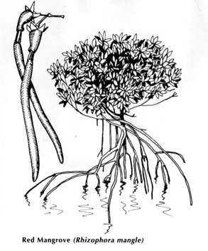
Creek and Cadell Bay (Diglipur). The mangrove forests are highly developed along the mudflats, estuaries, and borders of lagoons where, at high tide, the brackish water covers the region. They are protected against strong wind and wave action. The group of islands are separated from each other by a narrow but deep mangrove fringed creeks through which steep, often fast tidal currents flow. Andaman and Nicobar Islands are known for their natural beauty, sandy beaches and rich marine biodiversity. Most of the islands are surrounded by fringing reefs on their eastern side and barrier reefs on the western side. The area covered by the reefs is about 2000 km2 i.e., 6% of the total continental shelf of these islands. They harbour rich population of corals, mollusks, fishes etc., and most of them have luxuriant mangrove closely associated with them. Coral reefs
of Andaman
|
|
|
Home
Publications New |
||
|
Home
|Institutions | Investigators|
Research | Results
| Management|
|
||