|
|
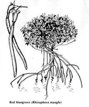
Muthupet Mangroves:
The
great vedaraniyam swamp is one of the largest coastal wetlands found
in the state of Tamil Nadu.It is located in the southernmost end of
the Cauvery delta, extending from Adirampattinam in the west (Thanjavur
District) to Point Calimer in the east (Nagapattinam District). The
Muthupet mangrove wetland is a part of the Great vedaraniam swamp. The
muthupet mangrove wetland is bordered in the south by Palk strait. In
the northern side extensive mudflats are present which are prone to
flood during the Monsoon season. Many of the Drainage Arteries of the
Cauvery delta namely, Nasuviniyar, Pattuvanachiyar, Paminiyar, Korayar,
Kilathangiyar and Marakakoraiyar empty their water into Muthupet mangrove
wetlands. For administration and Management purposes the forest department
divided the Muthupet mangrove wetlands into six reserve forests. Each
reserve forests (Rf) embodies different categories of wetland such as
healthy mangroves, degraded mangroves, Lagoon, tidal creeks and Creeks.
The total area of the Muthupet Mangrove is about 12020ha.Out of 12020ha,healthy
mangrove forest found only 1855 ha (15%). Where as, degraded mangroves
cover an area of about 7180.62 ha (60%). The area occupied by Lagoon
and other water bodies is about 1700 ha.
The Muthupet
mangrove wetland is characterized by the presence of the vast lagoon
occupying an area of about 1700 ha. It is a shallow brackish water body
with an average depth of about 1 to 2 feet during the low tide and 3
to 4 feet during the spring high tide. The lagoon connected to the Palk
Strait by a wide mouth (about 1.5 km). Number of tidal creeks, channels
and small Bays, bordered by thick mangroves are also found with in the
wetland. The average salinity of the water, particularly in the lagoon
shows wide variation. During monsoon the salinity varies from 5 to 15
ppt and in summer it reaches as high as 45 ppt, which is mainly due
to the shallowness of the lagoon.
Saltpans:
About
14 saltpans, occupying area of about 4082 acre are present around the
Muthupet mangrove wetland. Most of the saltpans are located very close
to the Palanjur Reserve land, Tamaram kottai, Maravakkadu.
Shrimp farms:
Apart
from the saltpan, a total number of 27 prawn farms are also located
close to mangrove forest. The total area of these farms is about 580
acre. Out of this, 376 acre is located on the Eastern side.
Major concerns of the Muthupet Mangroves:
- Decline in the fish catch in the last 15- 20 years
- Silt deposition in the mouth region of the Lagoon
- Pollution by shrimp farms.
|